

Good reception conditions from Australia on the 28th April 2009 included 5LN Port Lincoln on 1485 kHz. This time around I heard a fairly clear "ABC South Australia and Broken Hill" id insert and a regional weather report.
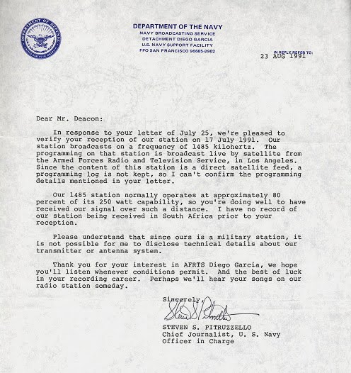
This morning I received an email verifying the unusual reception.


Google Street View of the 5LN antenna mast at Port Lincoln.
The 200 watt signal over a distance of 6 200 miles / 9 979 km also represents one of the most remarkable stations that I have been fortunate to hear with the tiny Sony SRF-M37V and 220 metre BOG.
 Google Earth Image showing the take off (great circle) bearing of the signal from Port Lincoln to Fish Hoek. After the take off above 30 km of land, the advantage of an all water path over the Indian Ocean would have contributed greatly to the signal getting through to Fish Hoek.
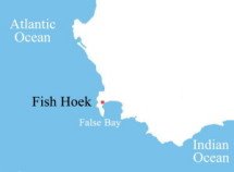
Google Earth Image showing the arrival (great circle) bearing of the 200 watt signal from Port Lincoln - a clear run above False Bay and only 1 km of land - to the dx location at Fish Hoek, over 6 200 miles / 9 979 km away !
Audio Clip


No comments:
Post a Comment